
 by Tim Doherty/photos by the author
Well before dawn in mid-December last year, hundreds of people waited in freshly fallen snow to see the first Green Line trains from Medford and Somerville head into Boston. This marked the first expansion of the Massachusetts Bay Transportation Authority Green Line in 60 years, and Boston’s first rapid transit expansion since the mid-1980s. But why does the Green Line even exist after nearly every other American city abandoned its streetcar system generations ago? The answers lie in how streetcars allowed the Boston metropolitan area to expand over the past 150 years and how well the core of the system was built to ensure its survival.
Streetcar service built the metropolitan area, expanding its size and scale as, initially, horse-drawn lines ran on radial routes outward from the city center. Better transit fostered development along these lines and around the streetcars’ frequent stops. Workers living outside of the city proper commuted to jobs and factories via ever-expanding streetcar lines. By the 1880s, ownership and streetcar operations were consolidated by West End Street Railway. Following the example set by the first electric streetcars in Richmond, Va., West End rapidly constructed new electric streetcar lines and converted horsecar routes to electric power, increasing the speed of travel and opening even more land to development.
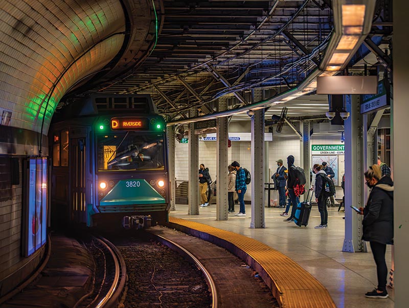
ABOVE: An outbound D train is at Government Center on March 15, 2022. The platform was once part of Scollay Square Station before it was replaced by the construction of Boston City Hall and renamed Government Center.
Streetcars provided direct service on each route into downtown Boston, which quickly collided with the network of narrow streets serving the compact business district. The staggering congestion of streetcars pushed the public sector to step in. By developing what are now the MBTA rapid transit lines, streetcars were systematically removed from the surface routes in the center of Boston.
Once the rapid transit lines were completed, the public sector leased them back to West End’s successor, Boston Elevated Railway, with restrictions on the fares that could be charged. However, operating as a for-profit private company with private investors holding bonds soon became impossible when the public sector demanded fares lower than operating costs required. In 1919, a public trustee was installed that could set fares; municipalities would cover any deficits and bondholders were guaranteed interest payments. This began a three-step process as the Boston transit system transitioned from private to full public ownership. In 1947, the commonwealth of Massachusetts bought out the bondholders and established the Metropolitan Transit Authority. Ultimately, MTA was folded into MBTA by adding commuter rail services in 1964.
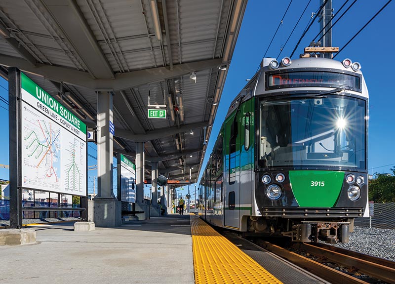
ABOVE: On September 27, 2022, one of 24 MBTA Type 9 cars waits to return to Government Center from the end of the line at Union Square. These cars were produced by the Spanish rail equipment builder CAF in Spain with final assembly completed in Elmira, N.Y. In 2022, CAF was awarded a follow-up order for 102 Type 10 supercars to replace the entire Green Line fleet.
Boston’s early embrace of public investment and ownership may have softened the three-step process to total public control and larger public investment. The public/private friction around mass transit in Boston and the initial belief that it should be profitable — despite all evidence to the contrary — established a long legacy of frugality and underinvestment that now requires massive spending to return the MBTA system to a state of good repair. References to this legacy regularly appear in reports dating all the way back to the 1950s.
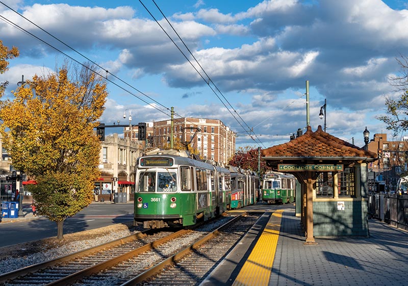
One of the early actions of the MBTA was commissioning a new image for the agency, including new paint schemes and signage, and a formal design guide for the transit system. The new line colors and graphic standards developed in 1966 continue to be used today. The bold colors of Red, Orange, Blue, Green, Yellow, and Purple represent the four rapid transit lines, bus, and commuter rail, respectively. The Green Line’s color came from the Emerald Necklace, the urban park designed by Frederick Law Olmsted that follows the border of Boston and Brookline. The Green Line’s five branches were each assigned letters: A – Watertown, B – Boston College, C – Cleveland Circle, D – Riverside, and E – Arborway.
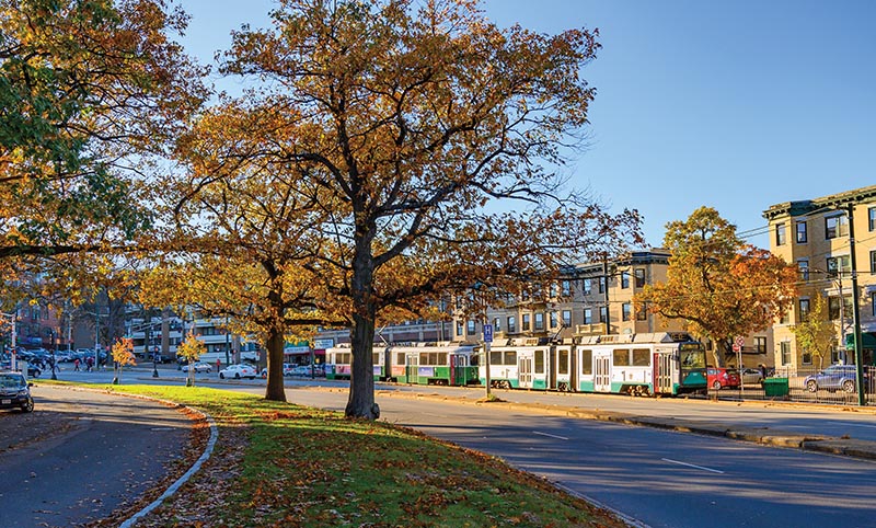
ABOVE: A Green Line train heads inbound in the trolley reservation along Commonwealth Avenue on November 1, 2019. The B Branch tracks along Commonwealth Avenue were originally constructed in reserved medians in the center of the street. The land along the streetcar routes saw the development of large, multi-family apartment buildings in the early 20th century.
At the core of the MBTA system is the Green Line’s Central Subway that runs below the high spine of Boston, connecting all the commercial districts from Kendall Square in Cambridge to North Station, the Financial District, downtown Boston, Back Bay, and the Longwood Medical Area, which contains nearly a third of the eastern Massachusetts real estate market. The Green Line serves three Boston sports teams, TD Boston Garden, Fenway Park, the State House, 12 colleges and universities, the Museum of Fine Arts, and the Boston Symphony Orchestra. MBTA’s other heavy rail rapid transit lines, which do not provide anywhere near the same connectivity in the city center, use the Green Line as a distributor of passengers transferring from the other rapid transit lines to their destinations within the city.
The First Subway
Beginning at Park Street Station on the corner of the Boston Common, the Central Subway opened on September 1, 1897, several years before the first subway lines opened in New York City. The initial section was designed for the small single streetcars used at the time, with many sharp curves, steep grades, and tight clearances. A year later, the route to the elevated platform at North Station opened via the portal at Haymarket, along with the now-abandoned leg to Tremont Street. The Tremont to North Station line was built as four tracks except for the section between Park Street and what is now Government Center…