

 by Tim Doherty/photos by the author except as noted
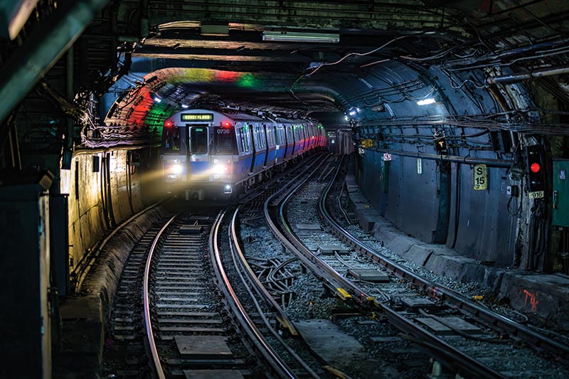
The missed romantic connections of two Bostonians along the Blue Line in the 1998 film “Next Stop Wonderland” make an apt comparison to the one Boston subway line still seeking its own connections with others. The Massachusetts Bay Transportation Authority’s Blue Line leaves downtown Boston, travels beneath Boston Harbor, emerges in East Boston, passes Revere Beach, and ends at Wonderland. Assembled in the first half of the 20th century from former streetcar lines and the route of the nation’s busiest narrow gauge steam railroad, it is one of four rapid transit lines operated by MBTA.
Built from five original islands in Boston Harbor, East Boston became part of Boston in 1836. Maverick Square was named for Samuel Maverick, its first resident, who grazed cattle on one of the islands. East Boston remained largely rural until the 1830s, when a land development company acquired the property, laid out streets, and sold lots. Because East Boston has no land connection to downtown Boston, residents had to cross the harbor. The first ferry service began in 1835 with two boats, East Boston and Maverick. As development spread, new land filled the gaps between the islands, while horse-drawn streetcars connected residents with ferry slips for the trip into the city.
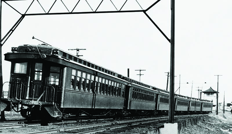
ABOVE: The three-foot gauge Boston, Revere Beach & Lynn was the only Boston-area railroad to electrify its main line. Always frugal, the railroad motorized its existing coaches for electric service, such as this train at Orient Height. Abandoned in 1940, the Blue Line uses the old right-of-way from Wood Island to Wonderland. —Roy W. Bruce photo, Otto M. Vondrak collection
Boston, Revere Beach & Lynn
One of the more unusual public transportation systems serving Boston was the 13-mile, three-foot-gauge Boston, Revere Beach & Lynn. Promoted and built as a land development scheme, the railroad tapped the city of Lynn’s desire for a competing route to Boston and opened large sections of Revere land acquired by developers. Built to three-foot gauge for economy, it became known to generations of passengers simply as the “Narrow Gauge.” Using its own ferry boats between East Boston and downtown Boston, the railroad opened in 1875 with service through to Lynn. Its route survives today as the outer segment of the Blue Line.
Ferries from East Boston crossed the harbor to Rowes Wharf, where passengers landed on Atlantic Avenue and, after 1901, could connect with the Atlantic Avenue elevated. From the East Boston ferry slip at the base of Jeffries Point, the railroad passed through a two-bore tunnel, then crossed tidal flats on a series of trestles to Orient Heights. Those flats were later filled to build Logan Airport. The railroad served six stations in Revere, including four along Revere Beach, before crossing the Saugus River into Lynn. Its traffic included businesses and residential neighborhoods, along with the hotels, amusement parks, and beaches of Revere. In 1884, the Narrow Gauge leased two storm-damaged lines in Winthrop and created a loop connecting with the main line at Orient Heights.
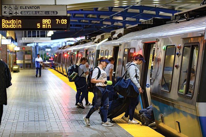
ABOVE: Members of the Suffolk University softball team board the Blue Line at Airport Station on September 12, 2025. They are traveling from their practice fields in East Boston to the university’s downtown Boston campus. —Tim Doherty
Narrow gauge service opened the 4.5-mile sandy expanse of Revere Beach to day-trippers from Boston and surrounding communities. As publicly accessible beaches disappeared elsewhere, civic leaders persuaded the state’s Metropolitan Parks Commission to take responsibility for Revere Beach. Bathhouses, restaurants, and private shacks that blocked views of the water were removed, and the railroad, originally built along the edge of the beach, was relocated 400 yards inland in 1895–96 to the present Blue Line alignment. Revere Beach reopened in July 1896 to a crowd of 45,000 and claims the title of the oldest public beach in the United States.
Operating with the intensity of a rapid transit line, Boston, Revere Beach & Lynn was likely the busiest narrow gauge railroad in the country. Although the line needed investment to handle its heavy traffic, management was reluctant to spend until an ownership change in 1927.
Boston’s only large-scale commuter rail electrification project began in 1928, when the Narrow Gauge was converted to overhead wire. In keeping with the railroad’s frugal nature, the existing passenger cars were rebuilt as electric multiple units rather than replaced with new equipment.
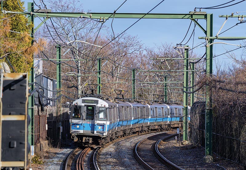
ABOVE: A Bowdoin-bound Blue Line train approaches Wood Island Station in East Boston on December 31, 2025. The line’s 94 No. 5 East Boston cars were built by Siemens and delivered between 2007 and 2009. —Tim Doherty
The timing could hardly have been worse. The Great Depression began at the end of 1929, and the commuter and beach traffic the Narrow Gauge depended on fell sharply. In 1934, the Sumner Tunnel opened, providing the first automobile route under Boston Harbor. The railroad struggled through the 1930s, hoping a public takeover by Boston Elevated Railway — whose streetcars paralleled much of the route — might save it. The Narrow Gauge finally gave up in January 1940.
After abandonment, much of the railroad quickly disappeared. Ironically, three former passenger cars survive today on the narrow gauge East Broad Top. Built in 1882 by Laconia Car Company, East Broad Top coach 8 and combines 14 and 15 were purchased from Boston, Revere Beach & Lynn in 1916. The wooden cars remained in regular use on East Broad Top until their replacement by new steel cars in 2022…