
 by Ken Edmier/photos by the author
French journalist Jean-Baptiste Alphonse Karr coined the phrase, “The more things change, the more they stay the same.” The ownership of one of the most beautiful subdivisions of any railroad may have changed on January 1, 2024, but the trains still run along the same towering mountains, cross rivers and streams on majestic bridges, and move freight through scenic vistas as they have for more than 140 years. Welcome to BNSF’s 4th Subdivision along the Clark Fork River in Western Montana.
Northern Pacific Heritage
The Clark Fork River runs almost 350 miles from Warm Springs, Mont., to Lake Pend Oreille, just west of the town of Clark Fork, Idaho. Northern Pacific construction crews arrived at Clark Fork in 1882 and built east along the Clark Fork River to Paradise, Mont. From Paradise, the line followed the Flathead and Jocko rivers and then down Evaro Hill, reaching Missoula, Mont., in summer 1883.
In 1891, NP built a branch line from Missoula to reach the mining town of Wallace, Idaho, following the Clark Fork River from Missoula to St. Regis, Mont. The 2.2 percent grade of Evaro Hill became a headache for NP, so a new connecting link between St. Regis and Paradise was surveyed. The new main line to Paradise via St. Regis was opened in 1909, often referred to as the river line.
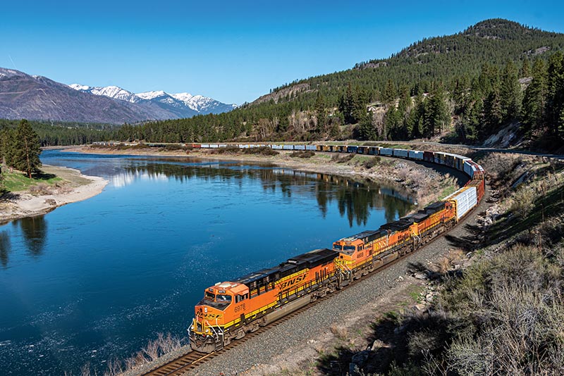
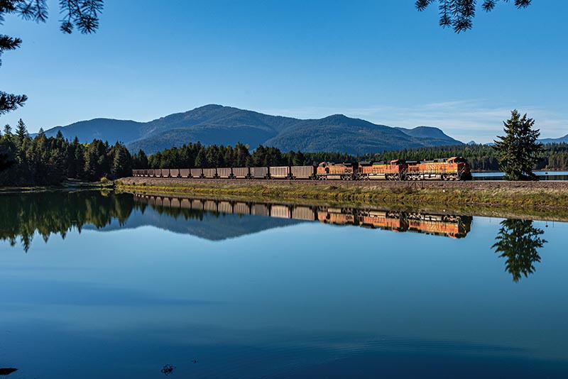
 ABOVE: A westbound manifest crosses the Clark Fork River near Donlan, Mont., on September 28, 2020. Additional support bridge members were added in 1990 to strengthen the bridge to handle increased railroad tonnage.
This new route was 20 miles longer, but excellent engineering limited the grade to 1 percent westbound and 0.5 percent eastbound. The new route also required five more crossings of the Clark Fork River, most through rugged mountain terrain. NP utilized the river line for most freight trains while still using the Evaro Hill line for passenger trains. The lines became part of Burlington Northern in 1970 and were leased to Dennis Washington in 1987 to become part of Montana Rail Link. In early 2022, BNSF and MRL announced the early termination of the lease agreement, bringing these lines under BNSF control in 2024.
Heading to St. Regis
Interstate 90 roughly follows the 4th Sub between Missoula and St. Regis. Leaving Missoula, the control point at DeSmet allows access over Evaro Hill via the 10th Subdivision. At Schilling, Mont., 13 miles west of Missoula, the remnants of a paper mill remain. Before closing in 2010, the mill was a major source of traffic for the railroad.
Continuing west, the railroad crosses the Clark Fork River at Huson, Mont., and follows the southern bank of the Clark Fork River until St. Regis. Of interest, the old roadbed of The Milwaukee Road’s Pacific Extension can be seen in many places along the north side of I-90. Located approximately 41 miles west of Missoula near Rivulet, Mont., the tracks cross over Fish Creek. This dramatic 576-foot-long trestle, located in the Fish Creek State Park, crosses over Fish Creek right before it flows into the Clark Fork River. Hiking the surrounding hillside affords spectacular views of the bridge and surrounding mountains.
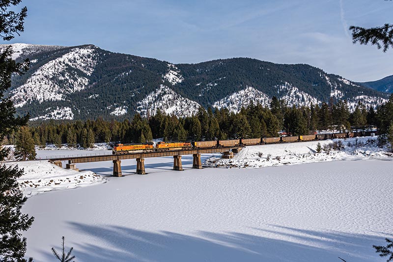
ABOVE: On a wintry January 28, 2022, a westbound loaded coal train crosses over Big Beaver Creek as it flows into the Clark Fork River at Trout Creek.
At St. Regis, both the railroad and the Clark Fork River turn north, passing under I-90 and the old Milwaukee Road railroad bridge; this is where the new line to Paradise left the original branch line to Wallace. In 1933, NP abandoned its own branch line between St. Regis and Haugan, Mont., after flooding took out major portions of the line, in favor of trackage rights on the parallel Milwaukee Road, and a new connection was built at St. Regis. The branch line from St. Regis to Wallace was abandoned by BN on September 2, 1980.
New Line to Paradise
The new 21-mile line from St. Regis to Paradise travels through the Lolo National Forest and was designed to the highest engineering standards, featuring five bridges over the Clark Fork River, three tunnels, and a maximum grade of 0.5 percent. For westbound trains, the line actually heads geographically northeast to Paradise.
Montana State Highway 135 parallels much of the railroad, with numerous vistas and pull-offs to view the line. The Peninsula Dispersed Campground and Recreation Area allows water level viewing of two of the five bridges over the Clark Fork River. The Muchwater Campground and Recreation Area allows for camping along the Clark Fork River with the railroad located just across the riverbank.
ABOVE: On September 24, 2021, an eastbound empty coal train crosses the Trout Creek causeway on a beautiful fall afternoon.
Paradise is the junction of the 4th Subdivision via St. Regis with the 10th Subdivision via Evaro Hill. Trains enter the junction over the last of the five bridges over the Clark Fork River. Today, the station is used by maintenance-of-way crews and the small yard is used to store idle freight cars, usually empty tank and Boeing flatcars. Paradise was also home to a tie plant built by NP in 1910, which continued in operation until it was destroyed by fire in 1982…